12.27.2011

GIS Applications: Discover Taipei in A More Convenient Way


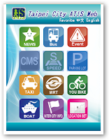
Tired of getting stuck in a traffic jam? In order to reduce traffic delays and promote tourism in Taipei, the Taipei City Department of Transportation cooperates with TMS Technologies to develop the Taipei City ATIS Website.


Previously, TMS Technologies has utilized SuperWebGIS as a developmental core of the GIS platform where the system can process and integrate spatial data from various departments and then broadcast the real-time traffic information to the public.


As a partner company of SuperGeo, TMS Technologies takes the advantages of GIS technical know-how and products offered by SuperGeo to build a GIS extension, ATIS, to promote urban traffic transmit and improve the transportation quality in Taipei.
Automatic Terminal Information Service, or ATIS, broadcasts the information about real-time road information, bus dynamic information system, and real-time available parking lot information.


Considering the booming popularity of smart phones, TMS Technologies has devoted to the development of mobile GIS applications. Therefore, an interesting and convenient App has been created to extend the application from Website to Mobile platforms for the public.


The App, called Easy Travel in Taipei, supports prevailing iOS, Android, and Windows Mobile operation systems. By using mobile devices, the public can not only obtain the real-time traffic information, but also plan your favorite cycling routes for relaxation with ease and fun.


For more information about the application story, please visit http://www.supergeotek.com/Library_2_201111.aspx

12.22.2011

GIS Application: Importance of Pollution Control


Have you ever been to Taiwan? Located in the north-east Taiwan, Yilan is a famous hot spot where visitors can enjoy its natural beauty, rich culture, and heritage.

To protect and preserve the valuable natural environment, recently we’ve cooperated with the Department of Environmental Protection Yilan and supported the project of improving the pollution control and management.

We’ve established a platform named Yilan Pollution Control GIS with SuperGIS Server allowing organizations to distribute GIS data and web services easily via the Internet.

The project is mainly to collect GIS data collection, develop prototype system, and ensure a smooth operation to meet the governor’s expectation.

The Environmental Pollution Control GIS platform currently focuses on integrating all kinds of pollution modeling analyses such as marine and air pollutions which enable decision-makers to combine the data with existing pollution layer for further application use.

Please visit at http://www.supergeotek.com/Library_2_201112.aspx for more information about Environmental Pollution Control GIS

12.01.2011

SuperGIS Mobile Solutions for Android and Windows Mobile


We are very excited to share new product plans with you. SuperGeo extends your mobile GIS platform to Android OS now.

Having been working on the mobile GIS software on Windows Mobile, SuperGeo now is developing several applications for Android OS.

In addition to current SuperGIS Mobile Tour, we will release SuperSurv, the data collection and survey software for Android devices, expected in one month (Dec 2011). The next product plan is SuperGIS Mobile Engine for Android (SDK).

For more details, please go to http://www.supergeotek.com/Mobile_Solution.aspx

The new product can be tested for free in Jan 2012. Welcome to download at www.supergeotek.com.