12.27.2012

SuperGIS Training Course Offered by International Integrated Environmental Service in Kuwait


We are pleased to share the event news with you. Our Kuwaiti exclusive reseller, International Integrated Environmental Services Ltd. (IIES) successfully offered the training course to Public Authority for Agriculture Affairs and Fish Resources (PAAF).

The training is only for PAAF. By enrolling on the professional GIS course, participants have gotten extensive training in how to use GIS technology to solve complex problems with integrated data and analysis.

With the aim of establishing a dynamic aquaculture GIS system to improve fishery management and foster sustainable aquaculture development, the personnel of PAAF utilized SuperGIS software to manage spatial data, perform analysis and further share GIS content on the Web across the organization to improve operational efficiency.

To continually expand the GIS market in Kuwait, SuperGeo will continuously work in close collaboration with IIES, helping local clients stay competitive in a challenging environment.


12.25.2012

The Enhanced SuperGIS Software to be Launched in Q1 2013


We are pleased to inform you that the diverse GIS software, including mobile GIS, server GIS, and desktop GIS, will be launched soon to provide you with more comprehensive GIS solutions.

In 2012, SuperGeo released a variety of GIS products and solutions to ordinary users and enterprises around the world. For example, the launch of SuperGIS Desktop 3.1 and extensions help users to visualize, process, analyze, and manage a variety of geospatial data effectively. For mobile GIS applications, SuperGeo released SuperSurv 3 for Android-powered devices and SuperPad 3.1 for Windows Mobile systems for effective data collection.

In addition, SuperGIS Server 3.1 and SuperGIS Network Server 3.1 were also introduced to offer enterprise GIS platforms which equips with powerful analysis functions and capabilities to publish various GIS services.


For the coming Q1 2013, the new launches of SuperSurv 3.1 and Mobile Cadastral GIS 3.1 can enhance the functions to meet the requirements in field survey. SuperGIS Desktop 3.1a will be introduced to support SuperGIS Toolkit and improve manipulations such as map viewing, attribute table, etc. SuperGIS Server 3.1a Value and Standard editions will be available to create, manage, and distribute geoprocessing and GIS services.

For more information about SuperGIS software, please visit

http://www.supergeotek.com/products_all_product_list.aspx

The free trial is available at http://www.supergeotek.com/download_6.aspx

12.24.2012

Happy Holidays!


Dear Friends,

May this Christmas end the present year on a cheerful note and make way for a fresh and prosperous new year.


Wish you Merry Christmas and a Happy New Year!

12.17.2012

Building Custom Website Using SuperGIS Server Flex API Samples


SuperGIS Server Flex website customization samples and references now are available on SGDN website for helping you develop and customize map websites with ease.

SuperGIS Server 3.1 increases the capability of creating, managing, integrating and publishing variety of map services for organizations, ensuring that your mapping services can be applied to desktop, mobile and web applications via the Internet.

Based on Flash technologies, SuperGIS Server Flex API allows for building diverse convenient and visual web applications effectively. With SuperGIS Server map services, SuperGIS Server Flex API can be applied to meet front-end users’ different requirements such as map display, map query, graphic drawing, etc.

The current website custom topics provide developers with complete sample codes and links connecting to the sample websites for further references. The Flex API related samples will be added on SGDN website later this week.

A variety of SuperGIS Server Flex API Samples are available at http://sgdn.supergeotek.com/supergis_server_api_Flex.aspx


For more product information about SuperGIS Server 3.1, please visit http://www.supergeotek.com/ProductPage_SGS3.aspx


The free trial is available at http://www.supergeotek.com/download_6.aspx

12.10.2012

Server-based GIS for Epidemic Disease Management


As Air travel becomes more affordable today, the increased overseas travel has facilitated the spread of infectious diseases which will endanger citizens at home and abroad. To assist epidemic control personnel in comprehending epidemic situation of dengue fever, Centers for Disease Control, Taiwan develops an epidemic situation management system to assist in avoiding delay in any reporting of dengue fever and mastering the epidemic situation.


Situated in subtropical zone, dengue fever has gripped Taiwan in recent years. In order to take control of the epidemic throughout the country, the project aims to help CDC develop an epidemic situation management system by means of sever GIS software, store information of the infected patients and locations where dengue fever occurred, understand epidemic situation in each district, and then clearly distinguish whether the dengue fever is mainly caused by vector mosquito habitats.


The epidemic situation management GIS system ensures the infection control personnel to report dengue fever infection situation anywhere after logging into the online system and consequently employ map display and diverse analysis functions to determine the mutual relations among dengue fever occurrence, locations and vector mosquito habitats.


In this project, SuperGIS Server 3.1 was utilized as the GIS platform core to distribute and manage map information and build map websites. The server GIS allows developers to apply customization functions, Jquery and Javascript syntax to create their own map websites with interactive visual effects. Besides, the system adopts Microsoft SQL Server 2008 as the database management software to manage spatial-related indices and statistic information for efficient data querying.

Serving to integrate legal infectious disease cases with the location where diseases caused, the Epidemic Situation Management GIS System enables relevant departmental executives to access the information about controlled area of mosquito habitats, vector mosquito indices, position of public location, etc; meanwhile utilizing the accurate references to formulate disease prevention plans to combat the threat of communicable diseases and safeguard the life and health of the citizens.


More information about the application story, please visit http://www.supergeotek.com/Library_2_201212.aspx

More product information about SuperGIS Server 3, please visit

http://www.supergeotek.com/ProductPage_SGS3.aspx

12.05.2012

New Release of SuperGIS Engine 3.1 Beta


SuperGIS Engine 3.1 Beta version is available now. SuperGIS Engine 3.1 provides the collection of COM-based GIS components for helping developers build custom GIS applications.

As the core development of SuperGIS software, it can be embedded into programming language under Windows developing environment to integrate with other systems and enhance efficiency in system development.

SuperGIS Engine 3.1 provides 32-bit and 64-bit developing components that enable developers to create GIS applications they need in common development environments such as Visual Studio 2005/2008/2010 Visual Basic, VB.NET, Visual C# and so on.


Furthermore, SuperGIS Engine contains hundreds of GIS-related objects that allow developers to flexibly customize various applications and achieve diverse GIS manipulation functions such as layers overlaying, map viewing and querying, geoprocessing, etc.

More product information about SuperGIS Engine 3.1, please visit http://www.supergeotek.com/ProductPage_SE.aspx

The free trial is available at http://www.supergeotek.com/download_6.aspx

11.26.2012

SuperGIS Desktop 3.1a Beta 4 Now Available


We are pleased to announce that SuperGIS Desktop 3.1a Beta 4 is available to help you display, edit, manage, query and analyze spatial data easily with its comprehensive and plentiful GIS tools and easy-to-use interface. Also, SuperGIS Desktop 3.1a enhances the manipulation of attribute table, map query, map navigation and so on.
In addition to keeping improving the stability of manipulation, SuperGIS Desktop 3.1a Beta 4 adds SuperGIS Toolkit to provide hundreds of GIS analysis functions. Through employing Process Designer of SuperGIS Desktop 3.1a, users are not only able to define geoprocessing functions and workflows to meet their requirements but also process single data and batch data directly.


SuperGIS Toolkit provided by SuperGIS Desktop 3.1a not only improves the efficiency of processing spatial data and significantly decreases cost and time of the workforce. Besides, developers can apply the functions and workflows defined by SuperGIS Toolkit and work with SuperGIS Server 3.1 Standard Edition to publish the geoprocessing services to the front-end website so that users can utilize the GIS analysis functions with browsers with ease.

SuperGIS Desktop 3.1a will be officially launched soon. For more product information, please visit http://www.supergeotek.com/productpage_SG3.aspx

The free trial is available at http://www.supergeotek.com/download_6.aspx


11.19.2012

Android-powered Mobile Cadastral GIS 3.1 to Be Launched


We are pleased to announce that Mobile Cadastral GIS 3.1 for Android-powered devices will be launched soon in Taiwan. Designed to make efficient cadastral position, field survey and measurement, Mobile Cadastral GIS integrates with GIS, GPS, and e-compass technologies to help field surveyors quickly locate their current position and cadastral information to accomplish filed tasks effortlessly.

The newest Mobile Cadastral GIS 3.1 enhances query function that allows the field workforce to query cadastral information instantly by utilizing GPS, selecting, inputting cadastral information and so on. With Mobile Cadastral GIS 3.1, surveyors can easily obtain perimeter and area value of the section and cadastral data.

In addition, Mobile Cadastral GIS 3.1 will support the save function, enabling users to record the queried cadastral information. Therefore, the query results can be achieved and exported as TXT format for further application uses.

Mobile Cadastral GIS is available for conducting Cadastral data survey in Taiwan. The application has successfully assisted local governments in completing many survey tasks. For more product information about Mobile Cadastral GIS 3.1, please contact us at staff@supergeotek.com.

For more product information about SuperGIS software, please visit http://www.supergeotek.com/products_all_product_list.aspx

The free trial is available at http://www.supergeotek.com/download_6.aspx

11.13.2012

Web-based GIS for Campus Emergency Response


Accurate and reliable spatial information of an event nowadays plays a crucial role in minimizing human and asset losses. With the aim of preventing disastrous damage caused by sudden natural disasters, Chien Hsin University of Science and Technology, Taiwan, develops the hazard prevention Web GIS program for enhanced simulation and drills and effective emergency response during earthquakes, tsunami, and fires.

To help people improve preparedness and practice how to keep safe during earthquake strikes on campus, Chien Hsin University of Science and Technology conducts biannual earthquake and fire emergency response drills for nearly four thousand participants. The drills always put a strain on the Office of General Affairs.

Developed with SuperGIS Server 3 and Microsoft SQL Server 2008, the Web-Based Campus Emergency GIS System performs dynamic map display, basic GIS manipulation, and map navigation, delivering high quality spatial information for students and administrators in every department on campus to visualize, integrate, and analyze student population, facilities, and hazard data for better emergency planning and preparation.


The Web-based Campus Emergency GIS System is expected to integrate the information such as the evacuation routes, distribution of evacuation equipments and fire-fighting facilities, and lists of emergency personnel, to satisfy the requirements in class training and simulation drill of different situations. Therefore, a safe campus for study and work can be ensured and enhanced by means of GIS technologies.

More information about the application story, please visit http://www.supergeotek.com/Library_2_201211.aspx

More product information about SuperGIS Server 3, please visit

http://www.supergeotek.com/ProductPage_SGS3.aspx

11.05.2012

SuperGIS Server API Samples Available Now


System developers now can use plenty of SuperGIS API samples and object references to easily customize the map websites with SuperGIS Server 3.1.

With SuperGIS Server 3.1, you can create, manage, integrate, and publish various types of GIS services over the Internet to support desktop, mobile, and web applications. In addition, SuperGIS Server 3.1 offers JavaScript, Flex, and Silverlight APIs to customize map websites flexibly and effectively to meet demands in different cases.

In order to help developers to comprehend and apply SuperGIS Server API fleetly, we offer a variety of SuperGIS Server JavaScript APIs on SGDN website (SuperGeo Developer Network website). Every API sample provides comprehensive sample code and the live demo website, enabling developers to find the suitable sample efficiently according to the diverse topics.

SuperGIS Server Flex API and Silverlight API will be provided on SGDN website soon. A variety of SuperGIS Server API Samples are available at http://sgdn.supergeotek.com/supergis_server_api_JavaScript.aspx

SuperGeo GIS Forum: http://www.supergeotek.com/Forum/default.aspx?g=forum

For more product information about SuperGIS Server 3.1, please visit http://www.supergeotek.com/ProductPage_SGS3.aspx


The free trial is available at http://www.supergeotek.com/download_6.aspx

10.30.2012

SuperGIS Server 3.1 Standard Edition to Support to Work with SuperGIS Analysts


Scheduled to be released at the end of 2012, SuperGIS Server 3.1 Standard Edition will support to work with SuperGIS Analysts for increasing analysis capabilities to you.

SuperGIS Server is designed for organizations to create, manage, integrate and publish the various types of GIS services. By utilizing SuperGIS Server, the spatial data and images in all types as well as GIS functions can be deployed as GIS services in desktop, mobile and web applications over the Internet.

The latest server-based GIS software supports to publish Geoprocessing Service, allowing organizations to create geoprocessing functions and workflow with SuperGIS Toolkit in SuperGIS Desktop and publish the defined functions and workflows to website via SuperGIS Server.

In addition, a variety of analysis extensions such as SuperGIS Spatial Analyst, SuperGIS 3D Analyst are available to increase GIS capabilities and help users publish advanced analysis functions with SuperGIS Server 3.1 Standard Edition to diverse front-end platforms to enhance GIS data processing capabilities and distribution.

SuperGIS Server 3.1 Standard Edition is going to be released by the end of 2012. For more product information about SuperGIS Server 3.1, please visit http://www.supergeotek.com/ProductPage_SGS3.aspx

The free trial is available at http://www.supergeotek.com/download_6.aspx

10.22.2012

The Newest Android-powered Mobile Survey GIS SuperSurv 3.1 to Be Launched


SuperSurv 3.1, the mobile survey GIS, will be launched at the end of 2012. SuperSurv 3.1 optimizes the editing functions and enhances layer management, allowing for an easy-to-use user interface.


Designed for Android users, SuperSurv 3 can complete effective data collection in fields. Integrating with GIS and GPS technologies, SuperSurv 3 helps surveyors collect spatial data with ease and supports vector layer file such as GEO and SHP.


By employing the mobile GIS application, field workforce can utilize SGT cached map and the map service published by SuperGIS Server as basemap to expedite the efficiency of filed survey. Moreover, SuperSurv works with GPS, camera, and custom attribute table, allowing users to collect and record attribute data and photo information of point, polyline, and polygon features.

With the newly-added editing functions such as feature rotation, snapping, etc, SuperSurv 3.1 helps accomplish feature editing on mobile devices efficiently. Furthermore, users can also modify the layer transparency to display and navigate the layers from diverse sources more flexibly and easily.

For more product information about SuperSurv 3, please visit http://www.supergeotek.com/ProductPage_SuperSurv.aspx


The free trial is available at http://www.supergeotek.com/download_6.aspx

10.16.2012

SuperGIS Toolkit to Be Supported in SuperGIS Desktop 3.1a for Data Processing and Analysis


We are glad to inform you that the SuperGIS Toolkit will be provided with SuperGIS Desktop 3.1a to increase the capability of data processing and analysis.


Serving as the desktop GIS, SuperGIS Desktop provides you with a professional platform with diverse GIS tools to effectively and easily perform spatial data as well as display, edit, manage, query and analyze the related data.
The latest SuperGIS Desktop 3.1a will be able to speed up the data processing with SuperGIS Toolkit that performs hundreds of GIS functions and enables users to define the needed geoprocessing functions and the workflows and perform patch data processing.


Compared with the previous functions, SuperGIS Toolkit enhances the efficiency in processing and saves the time on repeated manipulations. Those functions and workflows defined by SuperGIS Toolkit will be able to be published to the front-end website by SuperGIS Server 3.1 Standard Edition in the near future.

For more product information about SuperGIS Desktop 3.1, please visit http://www.supergeotek.com/productpage_SG3.aspx


The free trial is available at http://www.supergeotek.com/download_6.aspx

10.08.2012

GIS System for Cycling Team Management


When global warming is affecting the natural environment of the world, cycling becomes an important and popular activity all over the globe and many cities have designed bike lanes to save on gas consumption. Take Taiwan as an example. The use of bicycle on campus is greatly encouraged as the best way of daily transportation for students.


In order to promote safe bike riding and prevent car accidents, Taipei Chengshih University of Science & Technology (TPCU) integrates the visualized map website with mobile App on smart phones to show the current position and road conditions instantly for cyclists. The mobile App for Android users can record and report back riders’ current point and consequently transmit their moving traces to the server.

The Cycling Team Management System consists of website platform for displaying information of cycling team and the cycling team APP that is served as the vital tools for better reaction to the contingency on roads. The system has the front-end website to display the map and the back-end platform to manage personal information of each rider such as name, telephone number, etc.

Adopting SuperGIS Server 3 as map server, the website platform allows the cycling team administrators to publish and manage the existing map information, integrate riders’ current positions with map website to monitor each rider’s condition. Thus, the administrators can instantly provide the riders with emergency aid when an accident happens.


More information about the application story, please visit http://www.supergeotek.com/Library_2_201210.aspx


More product information about SuperGIS Server 3, please visit

http://www.supergeotek.com/LandingPage_SGS3.aspx

10.01.2012

SuperGIS Spatial Statistical Analyst 3.0 to Be Launched


The newest SuperGIS Spatial Statistical Analyst 3.0, an extension working with SuperGIS Desktop 3.1, will be launched in Q4 this year. with the mission of integrating geographic statistical analysis methods, the software enables users to investigate, query, and display spatial data and attribute data and manipulate basic statistical functions in GIS.

Furthermore, SuperGIS Spatial Statistical Analyst 3.0 adopts geographic statistical analysis methods to analyze spatial data, helping users realize variation and dependence of spatial data and make better decisions for their organizations


Featuring the improved user interface, Thiessen Polygon and variogram analysis tools, SuperGIS Spatial Statistical Analyst 3.0 performs semivariogram analysis, covariance analysis, Krigings, Universal Kriging, Ordinary Kriging, Co-Kriging, and Indicator Kriging.


For more information of the analysis extension, please visit http://www.supergeotek.com/products_desktop_SSA.aspx, or contact us by email: staff@supergeotek.com.

9.24.2012

SuperGeo Awarded at Asia East Geospatial Forum 2012


Last week the SuperGeo team showcased our GIS innovations at Asia East Geospatial Forum and received positive and valuable responses from local GIS enterprises and users. We are glad to announce that one of our geospatial technology applications, Emergency Response and Disaster Prevention Server GIS, is honored the best applications and usage of geospatial technologies of Asia Geospatial Excellence Awards 2012.


With the aim of emphasizing the issues and challenges in mainstreaming geospatial information into national development in Vietnam, the event functions as a networking hub to foster the relationship and exchanges between local GIS users and providers of geospatial software and solutions.


During this event, SuperGeo was not only interviewed by local journalist of Bao Xay dung online to share our recent achievements in the global GIS market but also invited to make a speech about The Role of SMEs for National Development which brought us some potential business opportunities.


Our product development plan for the coming future is to migrate our products to the new mainstream platforms like Windows 8 to retain our competitive advantages in the global GIS market and to satisfy your needs with world-class GIS products and services.

9.11.2012

GIS Assists the Workforce Development in Taiwan


Workforce development is a problem-solving approach that is often used to enhance a region's economic stability and prosperity. To help the governments in Taiwan understand more about the current situation of labor markets to enhance capital competitiveness of regional talents and receive clear information for effective decision making, Taiwan Training Center Bureau of Employment and Vocational Training has built a Workforce Development GIS Platform.


Developed with GIS technology, the system can widely collect related information of labor markets that includes both time and spatial aspects and integrate maps with database to conduct data exploration and analyses. Thus, the administrators of Taiwan Training Center Bureau are able to seize current situation, predict the future trend, and execute logical policy discussion.


Through SuperGIS Server 3, the server-based GIS software, the GIS Platform enables administrators to publish and manage current map data and to build general map websites with interactive visual effects via custom functions and Flex syntax development. Generally, the Labor Force Development GIS Platform can perform three functions, including Start Page, Map Display, and Data Export and Management.


In addition to displaying the maps and related attribute data instantly and correctly, the GIS system also offers clear indexes and an easy-to-use interface to promote the user-friendliness. Multiple and interactive statistical graphs brings analysis aspects with comeliness and convenience to the system. Users can therefore gain timely information for more applications and usability by means of GIS.


More information about the application story, please visit http://www.supergeotek.com/Library_2_201209.aspx

More product information about SuperGIS Server 3, please visit

http://www.supergeotek.com/LandingPage_SGS3.aspx

9.03.2012

SuperGIS Desktop 3.1a Beta 3 Now Available


We are pleased to announce that the newest version of desktop GIS mapping software, SuperGIS Desktop 3.1a Beta 3 developed by SuperGeo, is available now.


Featuring plentiful GIS tools and user-friendly manipulation environment, SuperGIS Desktop 3.1a allows GIS experts to display, edit, manage, query, and analyze diverse spatial data effectively.


The newest SuperGIS Desktop 3.1a enhances the manipulation of attribute table and map query, which enables you to easily navigate maps and export them to diverse formats. The whole new Graph add-on provided by SuperGIS Desktop 3.1a improves the interaction between the graph and the map selection.

Furthermore, SuperGIS Desktop 3.1a increases raster statistic file and raster pyramids to improve the efficiency of GIS operations and image processing and display. The SuperGIS Desktop 3.1a will be released officially in Q4 2012.

For more product information about SuperGIS Desktop 3.1, please visit http://www.supergeotek.com/productpage_SG3.aspx

The free trial is available at http://www.supergeotek.com/download_6.aspx

8.27.2012

New Release of SuperGIS Network Server 3.1


SuperGIS Network Server 3.1, the server software developed by SuperGeo, performs complete network analysis functions and network analysis calculation ability via web services to improve productivity for organizations.

Developed with SuperNetObjects 3.0, SuperGIS Network Server 3.1 performs multiple network analyses such as Shortest Path, Superior Route Planning, Closest Facilities, Service Area, etc.

SuperGIS Network Server 3.1 achieves the integration with other front-end platforms. The server GIS software allows developers to develop the web applications or mobile applications for Windows Mobile, Android, and iOS platforms.


Through employing SuperGIS Network Server 3.1 and SuperGIS Server 3.1, users can easily create a map website, carry out advanced network analyses, and publish map data via web services.

For more product information about SuperGIS Network Server, please visit http://www.supergeotek.com/ProductPage_NS.aspx

The free trial is available at http://www.supergeotek.com/download_6.aspx


8.20.2012

SuperGIS Server 3.1 Promotes Integration with OpenStreetMap


We are glad to announce that the latest SuperGIS Server 3.1 Value promotes the integration with OpenStreetMap. As a comprehensive server-based GIS, SuperGIS Server 3.1 allows organizations to create, manage, integrate, and publish a variety of spatial services.


To provide developers with a flexible server structure, the newest SuperGIS Server 3.1 Value Edition optimizes the ability to integrate with other platforms. In addition to the services delivered by Google Maps and ArcGIS Server, the services published by SuperGIS Server 3.1 can also be overlaid with OpenStreetMap services.

Administrators now are able to publish map services and overlay these services with OpenStreetMap after building the SuperGIS Server website. Consequently, the map website can be developed flexibly with richer contents to satisfy the users' needs.

Offering elastic server structure and strong ability in integration, SuperGIS Server 3.1 Value Edition assists developers in customizing their map websites with ease and displaying map services that are overlaid with other open GIS resources on the website.

For more product information and the instruction of customization, please visit

http://www.supergeotek.com/ProductPage_SGS3.aspx


The free trial is available at http://www.supergeotek.com/download_6.aspx

8.13.2012

SuperGIS for Disaster Evacuation and Rescue Plan


Climate change has increased the frequency and impact ranges of mass disasters all around the world. Disaster prevention and management therefore plays an important role in warding off diverse natural disasters. Take Taiwan for instance. Located in Circum-Pacific seismic zone, the island often faces threats due to the frequent typhoons and rainstorms.

To help the local government promptly respond to disasters, the Department of Geomatics of National Cheng Kung University utilizes the SuperGIS software to develop a disaster evacuation application, which provides related departments with references to undertake disastrous damage prevention programme.


The project focuses on integrating functions of GPS and GIS on application of smart phones that can be used in evacuation, rescue, and decreasing disastrous damage and casualties. Also, the Android-powered devices are used to display the GIS information for Disaster Evacuation and Rescue and can serve instant GPS coordinate positioning on local machine and support the connection to Web GIS Network Server on Cloud.

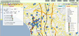
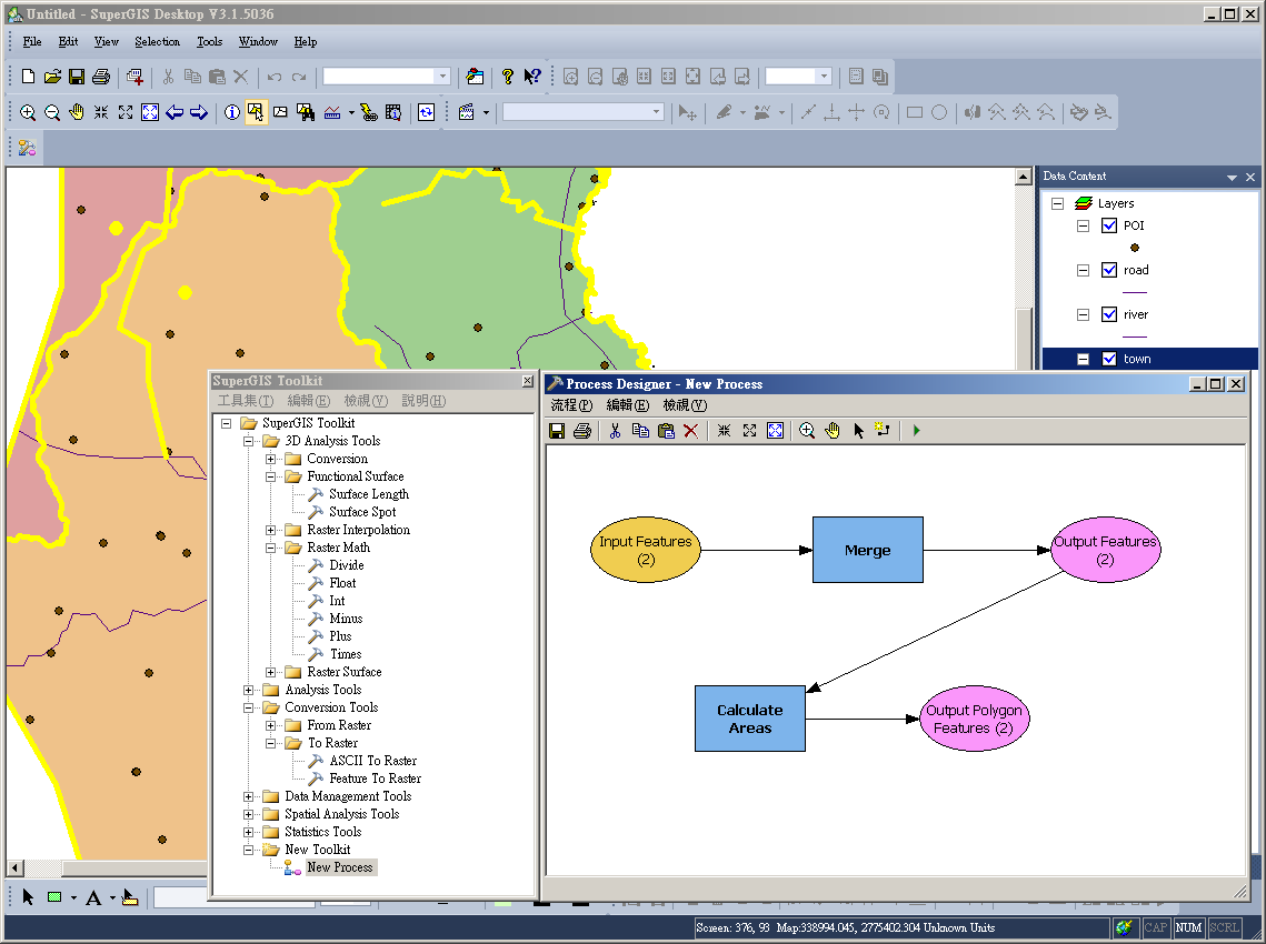
By working with SuperGIS Network Server, the application provides users with disastrous situation and network analyses for taking real-time traffic information such as road and bridge damage or prevention and rescue information from related sections into consideration. Consequently, the result of network analysis can be published in form of layers on map service on the mobile application for people to utilize.

Moreover, the Disaster Evacuation and Rescue system is developed as a mobile application (APP) for Android OS users who are evacuees or disaster relief personnel during accidents. Applying technologies like GPS, PDA and mobile GIS, the platform enables users to transmit the information of disaster prevention, rescue, and evacuation immediately and protect lives and property.

For more information about the application story, please visit http://www.supergeotek.com/Library_2_201208.aspx


More product information about SuperGIS Network Server, please visit http://www.supergeotek.com/products_server_NS.aspx

8.06.2012

Introducing the Newest SuperGIS 3D Analyst 3.0


The specialized extension, SuperGIS 3D Analyst 3.0, is launched to increase more capabilities to SuperGIS Desktop 3.1. SuperGIS 3D Analyst 3.0 offers 3D visualization and surface analysis method to input image, vector or elevation data to analyze surface change, query information or calculate visible range of the specific point on the surface.

With the 3D analysis too, you can overlay image data, vector data, and surface data, and simulate the real world and display 3D model. In addition, SuperGIS 3D Analyst 3.0 performs complete and optimal 3D analysis functions, including the support of triangulated irregular network (TIN), Generate Contours and Generate Steepest Path.


Delivering a user friendly interface and the manipulation environment, SuperGIS Globe can assist users in displaying 3D model which contains elevation data and comprehends 3D surface undulation by the fly tool.

Learn more product information about SuperGIS 3D Analyst 3.0 at

http://www.supergeotek.com/products_desktop_3D.aspx

The free trial is available at http://www.supergeotek.com/download_6.aspx

7.30.2012

SuperGIS Server 3.1 Achieves Integration with ArcGIS Server


SuperGIS Server 3.1 supports the integration with ArcGIS Server. As the comprehensive and server-based GIS software, SuperGIS Server 3.1 allows for creating, managing, integrating, and distributing a variety of GIS services. Therefore, the spatial data in all types as well as GIS functions can be applied to desktop, mobile, and web applications over the internet.

To provide developers with a more flexible server structure, the upgraded SuperGIS Server 3.1 focuses on optimizing the ability of integrating with the services of diverse platforms. The services published by SuperGIS Server 3.1 can be overlaid with both Google Map services and ArcGIS Server services.

By using the server-based software, administrators are able to add layers of ArcGIS Server into SuperGIS Server website, or to apply ArcGIS Server API and use SuperGIS Server map services to display the services of different sources on the same website.

With flexible server structure and great integration ability, SuperGIS Server 3.1 Value Edition helps developers customize map website to meet their requirements with ease. Furthermore, it enables the GIS experts who use ArcGIS Server to overlay SuperGIS Server services and ArcGIS Server services without changing their server structure.


For more product information and the instruction of customization, please visit

http://www.supergeotek.com/ProductPage_SGS3.aspx


The free trial is available at http://www.supergeotek.com/download_6.aspx

7.23.2012

SuperGIS Server 3.1 Supports Integration with Google Map Services


The latest SuperGIS Server 3.1 Value Edition achieves the integration with Google Map services, which allows you to create and share custom online mapping applications. The server-based GIS software increases the capability of creating, managing, integrating, and publishing a variety of services, ensuring spatial data and GIS functions can be applied to desktop, mobile, and web applications over the Internet.


Supporting a flexible server frame, the upgraded SuperGIS Server 3.1 performs more powerful functions to publish and manage GIS services, enhances the integration with the open GIS resources, and assists developers in customizing map websites with ease.


Through employing SuperGIS Server API and Google Map API, users are able to integrate map service published by SuperGIS Server with Google Map. Consequently, the SuperGIS Server services can be overlaid with Google Map in a map website while Google Map can be embedded in SuperGIS Server Website as the base map and overlaid with SuperGIS Server map services.


For more product information and the instruction of customization, please visit


http://www.supergeotek.com/ProductPage_SGS3.aspx or download the product manual via the link http://www.supergeotek.com/download_4.aspx


The free trial is available at http://www.supergeotek.com/download_6.aspx

7.16.2012

Newly Updated SueprGIS Server 3.1 Value Edition Available Now


We released SuperGIS Server 3.1, the comprehensive server-based GIS, which mainly enhances the integration with other GIS sources, such as OpenLayers, Google Map, ArcGIS Server, etc. The Server GIS software enables users to create, manage, integrate, and publish a variety of spatial data, image, and GIS abilities over the Internet.

Through using SuperGIS Server 3.1, GIS users can apply GIS services to desktop, mobile, and web applications. The server-based GIS software helps build ideal workflow and improve decision-making and labor productivity in your business.


The SuperGIS Server 3.1 Value Edition features the whole new SuperGIS Server Manager that enables administrator to publish and manage GIS services through web browsers. Furthermore, SuperGIS Server 3.1 Value Edition adds Web Map Tile Service (WMTS) that conforms to OGC standard.


To improve the efficiency of spatial data management, SuperGIS Server 3.1 offers the SuperGIS Server Map Cache Tool to produce cache map and maintain map service. Meanwhile, SuperGIS Server 3.1 increases the network analysis capability through integrating with SuperGIS Network Server 3, providing administrators with a more flexible server framework.

For more product highlights of SuperGIS Server 3.1, please visit

http://www.supergeotek.com/Library_1_201207.aspx


The free trial is available at http://www.supergeotek.com/download_6.aspx

7.09.2012

SuperGIS Mobile Engine Application to Public Lighting Management


SuperGeo cooperated with our Brazilian reseller, ENGESAT team, to assist Engeluz in optimizing public lighting facility management. Engeluz is an electrical engineering company, mainly providing local governments with the services and solutions to maintain and preserve the governmental properties.


Not only developing the public lighting management plan and a mobile GIS system with GPS function, Engeluz also offers the methods to monitor and conserve the Public Lighting System for improving the management efficiency of public lighting facilities.


In this project, the mobile GIS application plays an important role in helping the local government recognize the locations of the public lights and the electric energy consumption, carrying out the system maintenance, and optimizing the material and resource usage.


To establish a mobile GIS system to meet the governmental requirements, ENGESAT team supports Engeluz to adopt SuperGIS Mobile Engine 3 and develop Engeluz SGIP-Mobile application with camera and basic GIS manipulation functions, which enable surveyors and administrators to collect field data through the handheld devices such as PDA to fulfill any GIS tasks.


Featuring highly flexible development structure, over 100 out-of-the-box toolbar buttons, and rich development sample instructions, SuperGIS Mobile Engine 3 is a mobile GIS SDK that can assist developers in developing intuitive mobile GIS applications and deploying the customized applications to a variety of mobile devices.


For more information about the application story, please visit http://www.supergeotek.com/Library_2_201207.aspx


More product information about SuperGIS Mobile Engine 3, please visit http://www.supergeotek.com/ProductPage_SGME3.aspx

7.02.2012

SuperGeo at Taiwan Geographic Information Symposium 2012


At the end of June, we exhibited at Taiwan Geographic Information Symposium 2012 at Feng Chia University, Taiwan. The annual symposium aims to facilitate academic development of GIS and technical exchanges in geographic data development, value-added distribution, and advances on GIS technology and applications.


During the event, we showcased the latest SuperGIS software including SuperGIS Desktop 3.1 with the specialized extension products, SuperPad 3.1, the fully functional mobile GIS applications and the latest version of SuperGIS Server 3.1 which is scheduled to be release in Q3. The related GIS applications were also showcased to increase the ideas and usage of extensive GIS technologies.


In addition, we were specially invited to make the introduction of GIS software including the Android-powered mobile GIS software, SuperSurv3 and Mobile Cadastral GIS. The presentation has caught the attendees’ attentions and brought further opportunities of directly promoting the products to them.


By participating the event, visitors are able to experience the GIS innovations and learn how GIS technology can be employed in urban planning, disaster prevention and monitoring, intelligent transportation systems, and tourism management.


More information about SuperGIS software, please visit: http://www.supergeotek.com/products_all_product_list.aspx

6.25.2012

Enhanced GIS Learning CD and GPS Learning CD Available Now


We are pleased to announce the updates for GPS Learning CD and GIS Learning CD. After collecting the user feedback, we now re-issued the 2 learning CDs with improved text content, facilitating users to learn GPS and GIS knowledge clearly with vivid flash animation.


Designed for GPS beginners, surveyors, and GIS learners, the SuperGeo GIS Learning CD and GPS Learning CD collect complete concepts of the 2 professional domains. The GIS Learning CD mainly illustrates the various data manipulation and analysis, while the GPS Learning CD introduces the framework and applications of GPS. Each chapter comes with living animation, helping users understand the complex conception with ease and fun.


Since establishment, we have been dedicated to promoting geospatial knowledge for users in the related fields to get more comprehensive applications and practical usage. With sustainable innovation and progress, the company also newly released several upgraded “SuperGIS software” to support your field survey, GIS data operation, and effective web mapping.

More details of the SuperGeo GIS Learning CD and GPS Learning CD, please visit http://www.supergeotek.com/products_SuperGeoPress.aspx

6.19.2012

SuperField 3.1, the Lightweight Mobile GIS Software for Spatial Data Collection


The task-oriented mobile GIS software, SuperField 3.1 is launched by SuperGeo this week. Compared with SuperPad 3.1, the full-function GIS software containing diverse GIS tools and functions, SuperField 3.1 is especially designed for field workers who only require basic GIS functions to accomplish field investigation effectively.

For users who demand for basic GIS tools and data collection functions, SuperField 3.1 is the focused mobile GIS application, assisting users in accomplishing outdoor mapping and surveys in an economical and easy way. With SuperField 3.1, you can complete several field tasks such as adding, editing, and querying spatial data.

SuperField 3.1 supports multiple languages including English, French, German, Arabic, Portuguese, Spanish, Italian, Japanese, Korean, Polish, Russian, Turkish, Traditional Chinese, and Chinese. This allows non-English users to complete field task effortlessly and precisely.

With flexible customizing functions, SuperField 3.1 can be customized to fit users’ need in various projects. The mobile GIS software can also be developed with varied GIS functionally, like GPS, mapping and so forth, to fit the user requests from dissimilar applications.

For more product information about SuperField 3.1, please visit

http://www.supergeotek.com/ProductPage_SF3.aspx

The free trial is available at http://www.supergeotek.com/download_6.aspx

6.13.2012

GIS for Urban Disaster Prevention and Planning


Recently, we’ve completed a geographic information system (GIS) for the project of disaster prevention and planning. Located in Circum-Pacific seismic zone, Taiwan has high magnitude earthquakes frequently throughout the country. Thus, how to develop an effective urban planning system and disaster prevention plans becomes the most crucial issue to the local government.


We all know that the accurate distance measurement from each residence to the shelters is vital to Disaster Prevention and Planning. To assist Zhubei city (a city known for high-technology development in Taiwan) in achieving buffer results of shelter ranges with diverse considerations, SuperGIS Desktop 3 is used to build the spatial data of urban disaster prevention and analyze the temporary shelter range.


Setting parks and schools within the city as the shelter locations, the researchers can plan the buffer and compare different shelter ranges with four methods including “Buffer with radius value as 600 meters”, “Buffer with Facility Location Theory”, “Buffer with the actual walkable distance”, or “Buffer with the shelter which can be arrived at in five minutes”.


In this project, field surveyors also adopted SuperPad 3 for outdoor surveys and collect spatial and attribute data. Besides, according to buffer theory and research standard of spatial disaster prevention area, the spatial analysis tool helps build the spatial data through using aerial photographs, maps of city plans, field investigation methods.


More information about the application story, please visit http://www.supergeotek.com/Library_2_201206.aspx