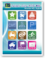
Tired of getting stuck in a traffic jam? In order to reduce traffic delays and promote tourism in Taipei, the Taipei City Department of Transportation cooperates with TMS Technologies to develop the Taipei City ATIS Website.
Previously, TMS Technologies has utilized SuperWebGIS as a developmental core of the GIS platform where the system can process and integrate spatial data from various departments and then broadcast the real-time traffic information to the public.
As a partner company of SuperGeo, TMS Technologies takes the advantages of GIS technical know-how and products offered by SuperGeo to build a GIS extension, ATIS, to promote urban traffic transmit and improve the transportation quality in Taipei.
Automatic Terminal Information Service, or ATIS, broadcasts the information about real-time road information, bus dynamic information system, and real-time available parking lot information.

Considering the booming popularity of smart phones, TMS Technologies has devoted to the development of mobile GIS applications. Therefore, an interesting and convenient App has been created to extend the application from Website to Mobile platforms for the public.

The App, called Easy Travel in Taipei, supports prevailing iOS, Android, and Windows Mobile operation systems. By using mobile devices, the public can not only obtain the real-time traffic information, but also plan your favorite cycling routes for relaxation with ease and fun.

For more information about the application story, please visit http://www.supergeotek.com/Library_2_201111.aspx
No comments:
Post a Comment