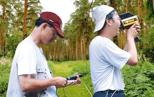
Under the cooperation between the Endemic Species Research Institute and SuperGeo Technologies, the Wild Creature Data Survey System is set up for efficent data management, and subsequently improves the conservation throughout Taiwan.
Adopting SuperGIS Mobile Engine as the core developing object, Wild Creature Data Survey System is mainly for filling in and submitting field data. It facilitates field surveyors to effectively create data, manage map and position on the mobile device with the user-friendly interface.
Surveyors can collect data swiftly by using this system installed in PDA, downloading data from the server or upload survey results to the server through synchronization with the server. In this way, the additional cost of processing survey data can be reduced.
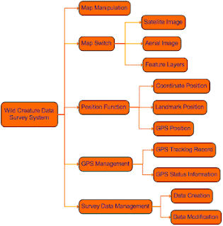
The key functions this system provides include map navigation and position, swithing and managing maps, survey data management and GPS management.

With the user-friendly interface, GPS function, and complete framework of Wild Creature Data Survey System, surveyors can collect and record data regarding domestic flora and flauna in the most effective way and meanwhile help improving the conservation in Taiwan.
For the complete story of Wild Creature Data Survey System, please visit http://www.supergeotek.com/Library_2_200907.aspx
No comments:
Post a Comment